Public Policy Institute of California’s Water Policy Center is looking for a researcher with
a background in civil or environmental engineering, hydrology or a related discipline and
water/natural resources policy, as detailed in this announcement. Candidates can be
recent grads or more seasoned researchers
Author: riverlab
The Nature Conservancy in California is hiring a River Scientist.
San Francisco Bay area: $85,100 – $100,000
Merced, Redding, Roseville, Sacramento, Santa Cruz, Truckee: $78,000 – $91,725
Chico, Fort Bragg: $80,000 – $83,375
The River Scientist will work closely with this interdisciplinary team to provide technical and scientific support to river conservation strategies across the Water Program, primarily within the Healthy Rivers strategy. This position will provide science support on projects that seek to restore or protect needed flow, improve instream habitat, and develop scientific tools to enable better management of California’s rivers and streams. Working closely with the Lead River Scientist, the River Scientist will perform a variety of analytical tasks, including reviewing and summarizing plans and reports, performing analysis of flow data, and evaluating the ecological implications of flow and stream restoration actions. The River Scientist will also assist with writing of reports and publications, grant administration, development of technical presentations, and managing science contracts.
The University of California Water Academy (UCWA) is a virtual seminar course open to both graduate and undergraduate students across all UC campuses. The course focuses on water policy and management in California and features interactive lectures, guest speakers, and collaborative group projects. The course runs from mid-January to mid-March 2025 and includes an optional river rafting trip in the summer.
The symposium was an in-person, free and open to the public event hosted on Saturday, December 7, 2024 9.30 am, 112 Bauer Wurster Hall, UC Berkeley.
PROGRAM:
9:30: Welcome by Zan Rubin (Balance Hydrologics and UC Berkeley)
Keynote Presentation by Erin Bray (San Francisco State University)
River mechanics for river restoration: How rivers warm and river rocks round (see bio
and abstract below)
10:30-12:00 Student Presentations
The Hydrologic and Geomorphic Response to Beaver Arrival on Rush Creek
Contrasting Goals and Outcomes: Comparing Restoration on Codornices and Wildcat
Creeks
A Decade Later: The Impacts of the Eden Landing Ecologic Reserve
Lost in Time: Evaluating step pool habitat two decades after restoration on Codornices
Creek
Assessing the Role of Marsh Restoration on Sedimentation, Flood Management, and Sea-
Level Rise: A Case Study of Walnut Creek
Cows and Water: How Grazing Alters our Waterways
12:00- 12:30 Concluding Panel: Reflections from Erin Bray (San Francisco State) and
Tami Church (US Army Corps of Engineers)Keynote Talk Abstract:
River mechanics for river restoration: How rivers warm and river rocks round
Along many rivers dams trap sediment and water released from the dam is cool and clear.
Downstream of the dam, temperature variability is controlled by climate that warms or
cools the water, the flow magnitude, and spectral properties of the water and the river’s
bed sediment. Separately, the grain size and shape of sediment on the bed is controlled by
the sediment supplied from hillslopes and fluvial sources, and the flow-driven abrasion
that contributes to particles getting smaller and rounder as they are transported along
stream. We developed a numerical river energy balance model to understand the controls
to river temperature. The Fluvial Energy Balance Model (FLUVIAL-EB) couples a full-
spectrum radiation balance model with turbulent heat fluxes, bed conduction, advection,
diffusion, and a 1D channel flow model over the length of the river, and is applied to
investigate temperatures along the San Joaquin River. We show that variations in the river temperature are sensitive to changes in the albedo of the sediment on the riverbed,
especially at smaller discharges and along abrupt gravel-to-sand transitions from dark
gravel to bright sand. A separate laboratory study uses a rock tumbler and angular rocks
sourced from nearby hillslope environments to investigate how river rocks round as they
tumble along river distances, to understand whether grain size reductions as opposed to
rounding is the dominant factor leading to sediment mass lost during abrasion. These two
studies highlight the importance of geomorphic processes on river sediment and
temperature, both of which support salmon spawning habitat.
Keynote Speaker:
Erin Bray is an Assistant Professor in the School of the Environment at San Francisco
State University (formerly the Department of Earth and Climate Sciences) where she leads
the Rivers Lab. Her research focuses on hydrology and fluvial geomorphology, with
emphasis on river processes and river restoration. Previously, she was an Assistant
Professor at California State University Northridge where she served as the Co-Lead for
the Water Science Program. Dr. Bray was a Postdoctoral Fellow at the University of
California, Berkeley, and the University of California, Santa Barbara, supported under a
fellowship from the Delta Stewardship Council. She received her Ph.D. from the
University of California, Santa Barbara, her M.A. from Brown University, and her B.S.
from Cornell University. Dr. Bray’s research focuses on hydrology and fluvial
geomorphology, with an emphasis on river processes, river restoration, and water
resources management. She has developed a model that, together with field measurements
and climate data, can be used to study impacts of flow releases from dams and climate on
the energy balance and water temperature of rivers. She also conducts in-situ field
measurements of saturated hydraulic conductivity to better understand the impacts of
sediment transport, sediment permeability, and flow on patterns of hyporheic exchange,
and how those patterns generate and sustain physical processes that support salmon
spawning habitat.
The San Francisco Bay Regional Board’s Watershed Management Division has an
opening for an Environmental Scientist in the streams and wetlands program. The
position involves writing permits for work in and around streams, wetlands, and SF Bay
under Clean Water Act Section 401 and the Porter-Cologne Act. Apply by 11/13/2024
For further information::
https://www.calcareers.ca.gov/CalHrPublic/Jobs/JobPosting.aspx?JobControlId=455097
The 20th Annual Berkeley River Restoration Symposium
Saturday, December 7, 2024 9.30 am, 112 Bauer Wurster Hall, UC Berkeley
The symposium is in person, free and open to the public. Please register here to reserve your spot
(and your printed program and coffee). Information on campus parking can be found here. Most
campus parking lots have paid parking available during the weekend.
PROGRAM
9:30: Welcome by Zan Rubin (Balance Hydrologics and UC Berkeley)
Keynote Presentation by Erin Bray (San Francisco State University)
River mechanics for river restoration: How rivers warm and river rocks round (see bio
and abstract below)
10:30-12:00 Student Presentations
The Hydrologic and Geomorphic Response to Beaver Arrival on Rush Creek
Contrasting Goals and Outcomes: Comparing Restoration on Codornices and Wildcat
Creeks
A Decade Later: The Impacts of the Eden Landing Ecologic Reserve
Lost in Time: Evaluating step pool habitat two decades after restoration on Codornices
Creek
Assessing the Role of Marsh Restoration on Sedimentation, Flood Management, and Sea-
Level Rise: A Case Study of Walnut Creek
Cows and Water: How Grazing Alters our Waterways
12:00- 12:30 Concluding Panel: Reflections from Erin Bray (San Francisco State) and
Tami Church (US Army Corps of Engineers)
Keynote Talk Abstract:
River mechanics for river restoration: How rivers warm and river rocks round
Along many rivers dams trap sediment and water released from the dam is cool and clear.
Downstream of the dam, temperature variability is controlled by climate that warms or
cools the water, the flow magnitude, and spectral properties of the water and the river’s
bed sediment. Separately, the grain size and shape of sediment on the bed is controlled by
the sediment supplied from hillslopes and fluvial sources, and the flow-driven abrasion
that contributes to particles getting smaller and rounder as they are transported along
stream. We developed a numerical river energy balance model to understand the controls
to river temperature. The Fluvial Energy Balance Model (FLUVIAL-EB) couples a full-
spectrum radiation balance model with turbulent heat fluxes, bed conduction, advection,
diffusion, and a 1D channel flow model over the length of the river, and is applied to
investigate temperatures along the San Joaquin River. We show that variations in the river
temperature are sensitive to changes in the albedo of the sediment on the riverbed,
especially at smaller discharges and along abrupt gravel-to-sand transitions from dark
gravel to bright sand. A separate laboratory study uses a rock tumbler and angular rocks
sourced from nearby hillslope environments to investigate how river rocks round as they
tumble along river distances, to understand whether grain size reductions as opposed to
rounding is the dominant factor leading to sediment mass lost during abrasion. These two
studies highlight the importance of geomorphic processes on river sediment and
temperature, both of which support salmon spawning habitat.
Keynote Speaker:
Erin Bray is an Assistant Professor in the School of the Environment at San Francisco
State University (formerly the Department of Earth and Climate Sciences) where she leads
the Rivers Lab. Her research focuses on hydrology and fluvial geomorphology, with
emphasis on river processes and river restoration. Previously, she was an Assistant
Professor at California State University Northridge where she served as the Co-Lead for
the Water Science Program. Dr. Bray was a Postdoctoral Fellow at the University of
California, Berkeley, and the University of California, Santa Barbara, supported under a
fellowship from the Delta Stewardship Council. She received her Ph.D. from the
University of California, Santa Barbara, her M.A. from Brown University, and her B.S.
from Cornell University. Dr. Bray’s research focuses on hydrology and fluvial
geomorphology, with an emphasis on river processes, river restoration, and water
resources management. She has developed a model that, together with field measurements
and climate data, can be used to study impacts of flow releases from dams and climate on
the energy balance and water temperature of rivers. She also conducts in-situ field
measurements of saturated hydraulic conductivity to better understand the impacts of
sediment transport, sediment permeability, and flow on patterns of hyporheic exchange,
and how those patterns generate and sustain physical processes that support salmon
spawning habitat.
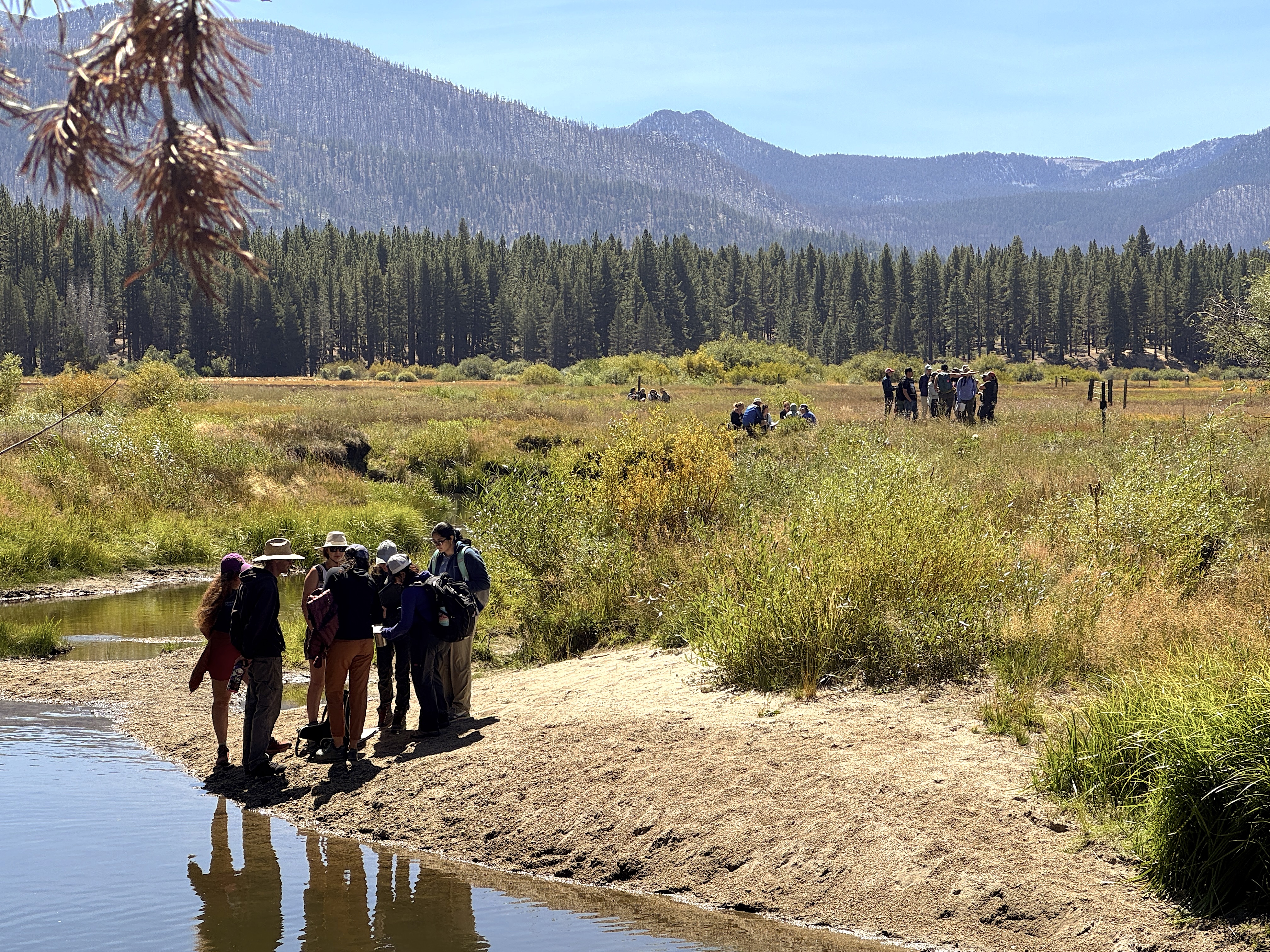
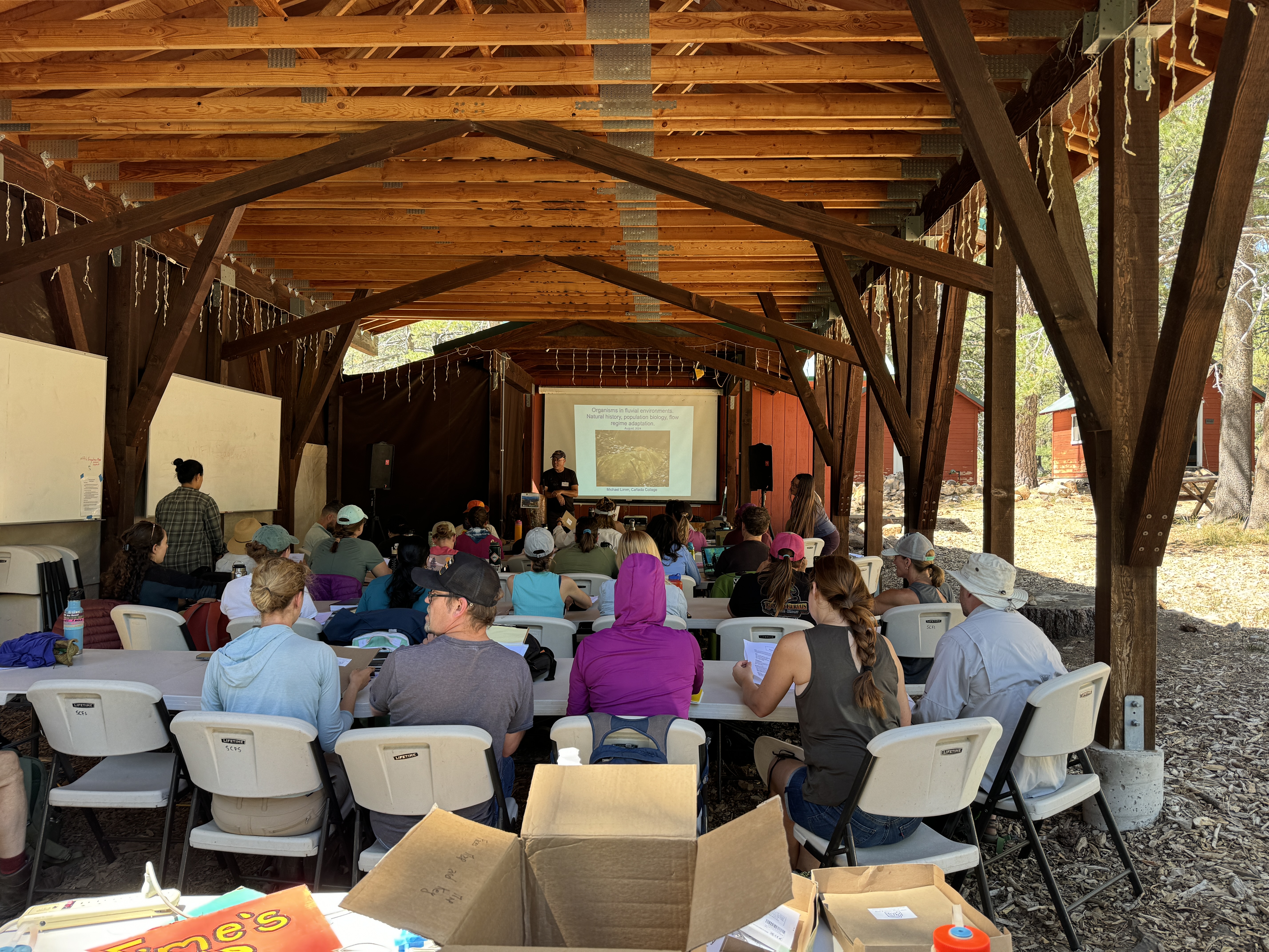
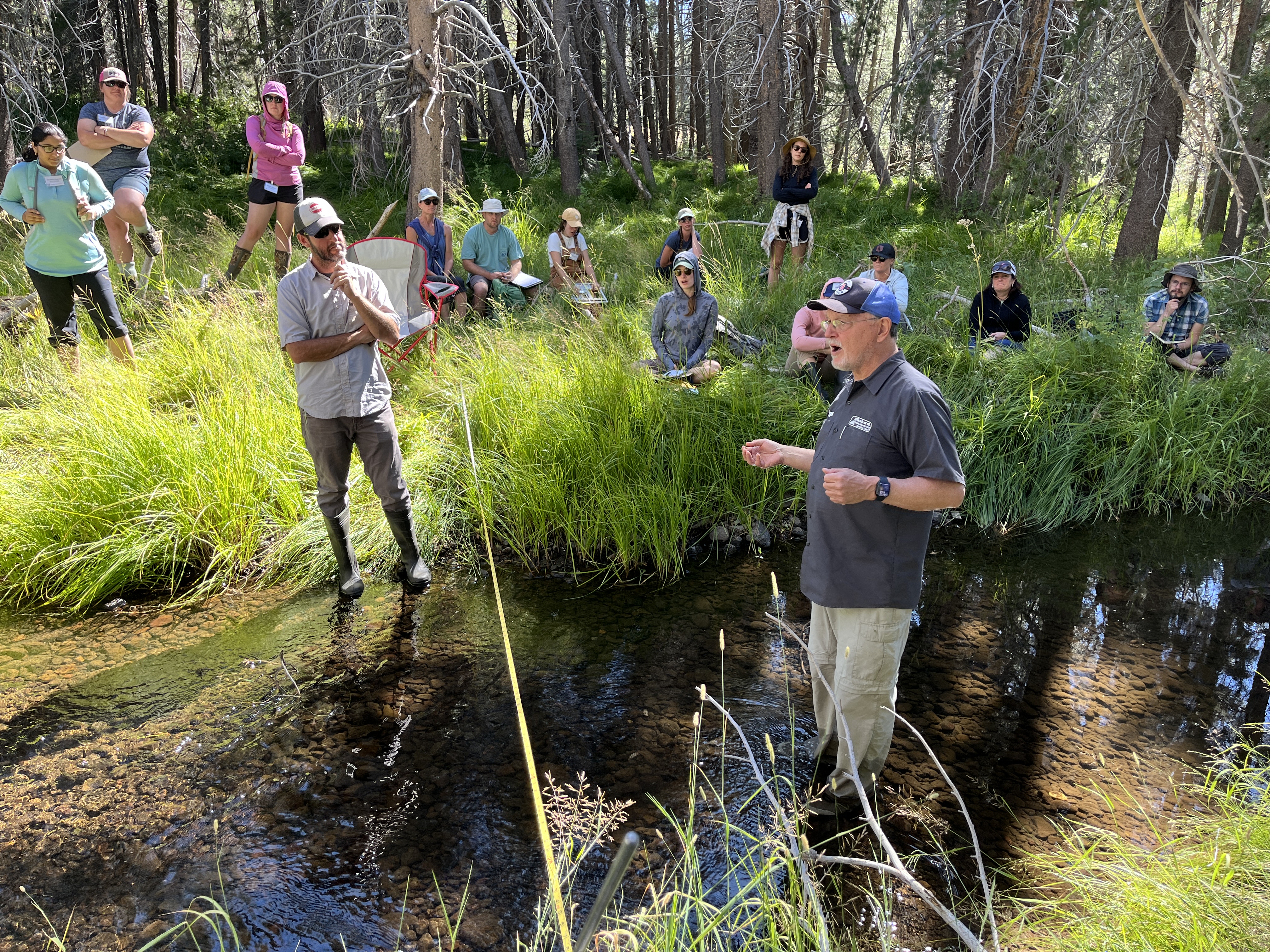
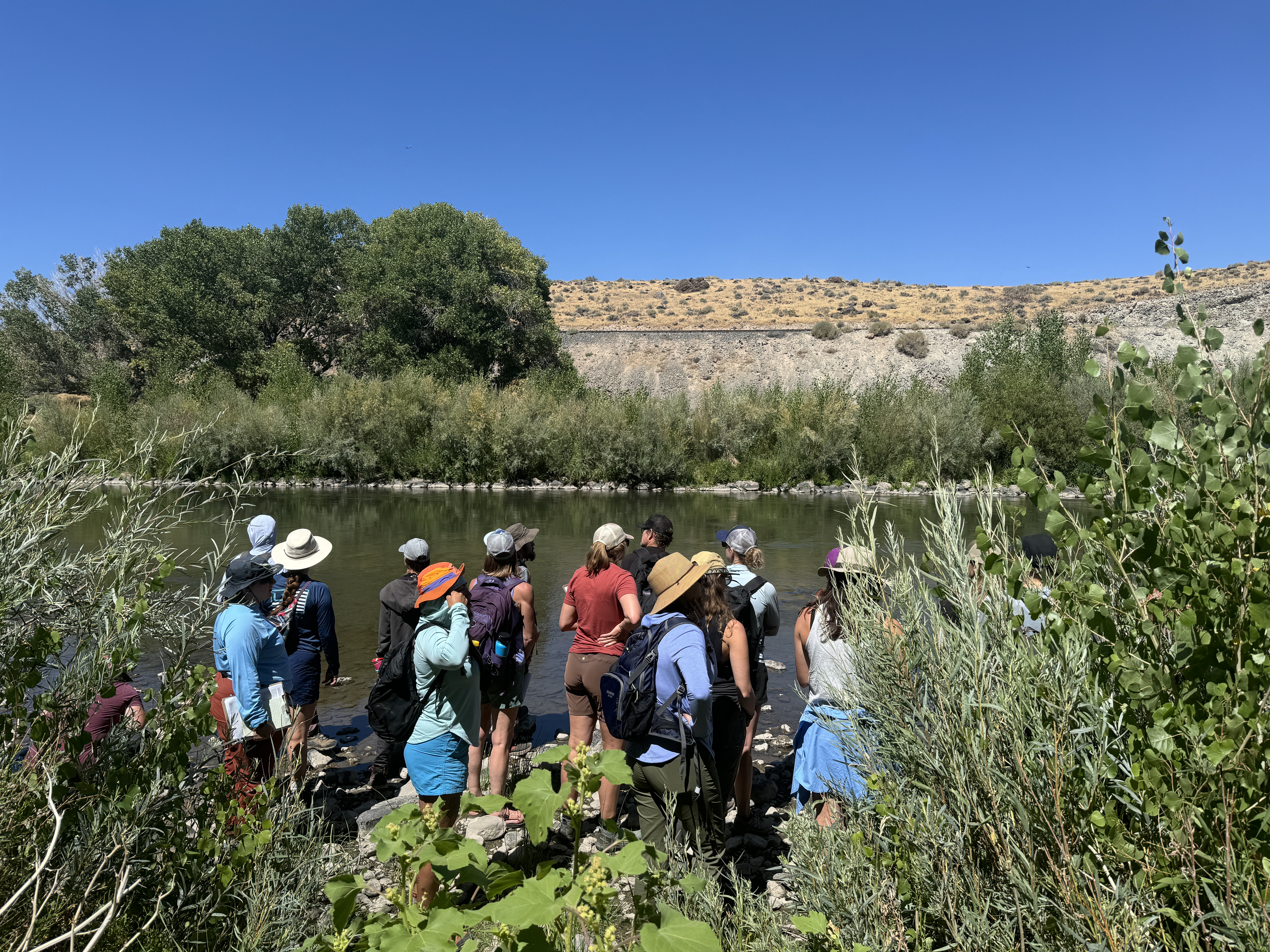
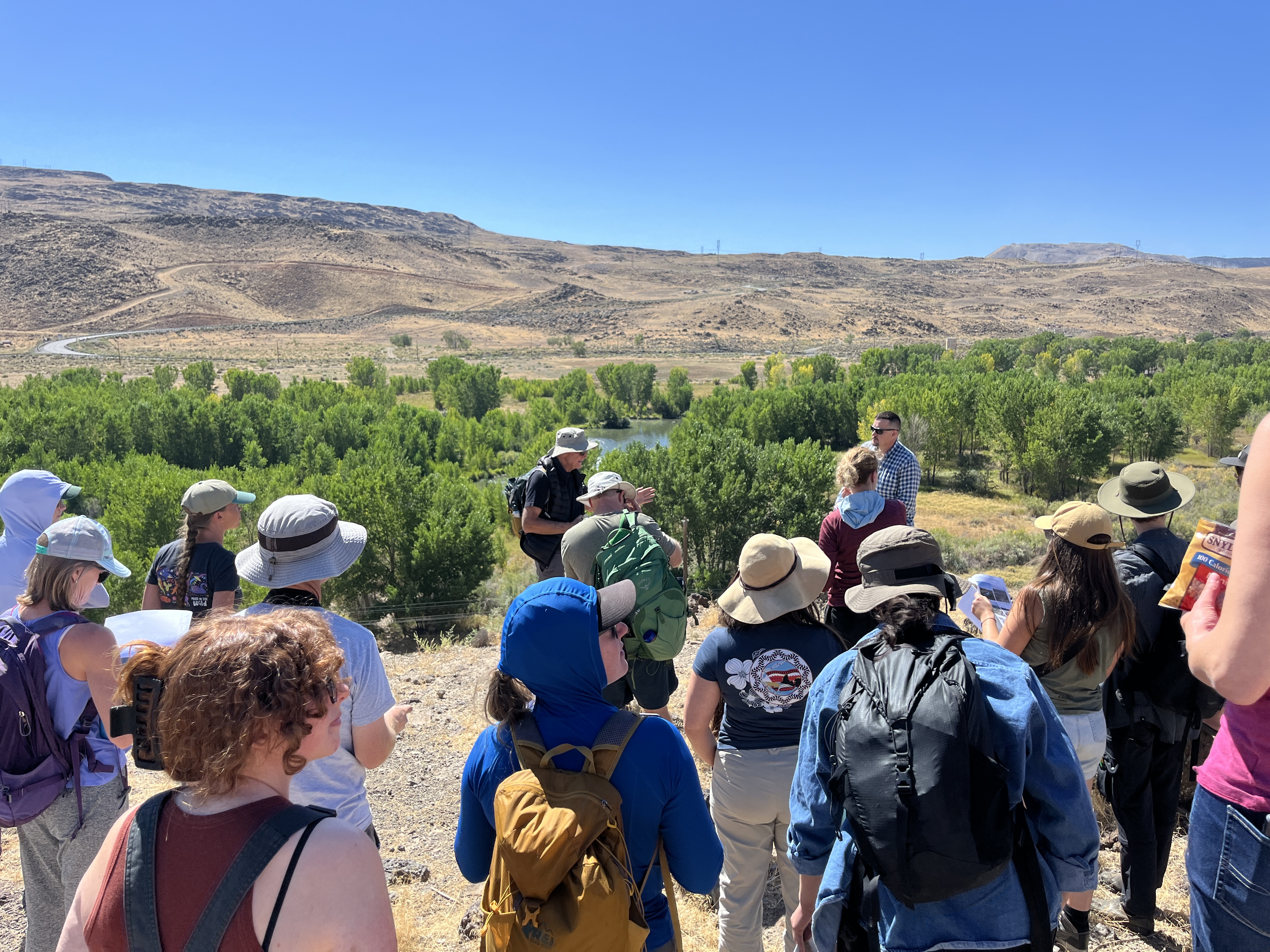
Over 30 participants joined the shortcourse Geomorphic and Ecological Fundamentals of River Restoration at Sagehen Ck Field Station near Lake Tahoe in August. Weather conditions were ideal, and participants got wet wading in Sagehen Creek and swimming in Lake Tahoe. They saw a wide range of completed projects as well as sites slated for restoration, and made proposals for most effective restoration approaches. Each evening participants enjoyed discussion of the day’s adventures followed by a gourmet meal in plein air. Next year’s shortcourse is set for 18-22 August. Registration opens in January.